Monterrico Map
Monterrico Maps
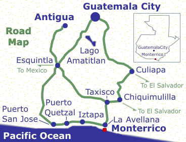
 Where is Monterrico?Road MapSatellite Images Where is Monterrico?Road MapSatellite Images
Below are two Monterrico maps and two satellite images of the area.
Where is Monterrico?
- Monterrico is a two to three hour drive south from either Guatemala City or Antigua. The roads take you from the highlands between the volcanos down to the Pacific coast.
- Other Guatemalan destinations:
- Antigua, Guatemala
Central America's most magnificent city.
- Lake Atitlan
The most beautiful lake in the world!
- Guatemala City
Where business is done.
- Tikal & Peten
Explore Tikal and the Mayan homeland.
|
 |
Road Map top
|
- Road map from Guatemala City to Monterrico:
- 1) Via Escuintla* and Puerto San Jose
Travel Time: 2 hours 30 minutes
- 2) Via Escuintla, Taxisco and La Avellana**
Travel Time: 2 hours 30 minutes
- 3) Via Chuilapa***, Chiquimulilla, Taxisco and La Avellana** Travel Time: 3 hours
- Road map from Antigua to Monterrico:
- 4) Via Escuintla and Puerto San Jose
Travel Time: 2 hours
- 5) Via Escuintla, Taxisco and La Avellana**
Travel Time: 2 hours 30 minutes
- * To go from Guatemala City via Escuintla you need to depart the city on Aguilar Batres.
- ** Once in La Avellana you will need to take a half hour ferry to Monterrico
- *** To go from Guatemala City via Chuilapa and Chiquimulilla you need to depart the city via Vista Hermosa on La Caratera a El Salvador.
|
 |
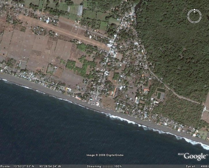
Satellite Images of Monterrico top
The easiest way to find a particular hotel is to look for signs when you get there. It's a small town and there are signs everywhere.
top
|
|
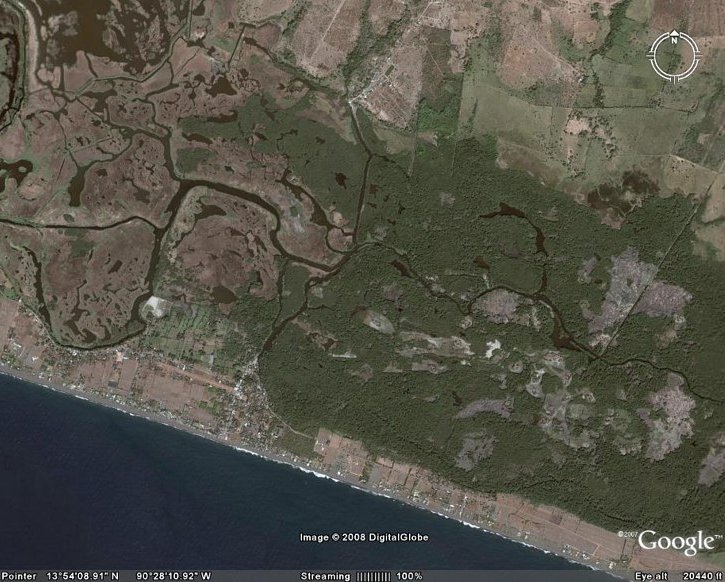
Below:
- The Nature Reserve is the lush green area. It extendes to the right.
- La Avellana, where you catch the ferry, is on the top, center.
top
|
|